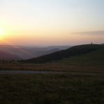
26 Hochpunkte liegen über 1400m.
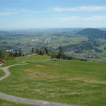
31 Bergstraßen, davon sind 23 für den öffentlichen Verkehr gesperrt.
| Rang | Hochpunkt | Region | maximale Höhe in m | Ausgangs-höhe in m | Länge in km | Höhendifferenz in m | mittlere Steigung | maximale Steigung | Baujahr | Kehren | Tunnel |
| 1 | Koblat | Oberallgäu/Bayern | 2068 | 824 | 9,2 | 1249 | 14,6% | 34% | 2008 | 23 | 0 |
| 2 | Kehlstein | Berchtesgadener Land/Bayern | 1805 | 517 | 13,2 | 1291 | 10,2% | 22% | 1938 | 24 | 5 |
| 3 | Bergstation Schlappoldsee | Oberallgäu/Bayern | 1770 | 953 | 7,3 | 832 | 13,1% | 25% | 2011 | 26 | 0 |
| 4 | Obere Bierenwangalpe | Oberallgäu/Bayern | 1737 | 953 | 6,7 | 789 | 13,2% | 24% | 1995 | 24 | 0 |
| 5 | Obere Gelchenwangalpe | Oberallgäu/Bayern | 1590 | 932 | 9,7 | 678 | 9,6% | 23% | 2003 | 6 | 0 |
| 6 | Rossfeld Nord | Berchtesgadener Land/Bayern | 1540 | 517 | 10,7 | 1023 | 9,4% | 14% | 1940 | 11 | 0 |
| 7 | Rossfeld Süd | Berchtesgadener Land/Bayern | 1540 | 517 | 13,5 | 1030 | 8,3% | 14% | 1940 | 11 | 0 |
| 8 | Hörnerbahn Bergstation | Oberallgäu/Bayern | 1530 | 876 | 3,6 | 654 | 19,0% | 32% | 1999 | 8 | 0 |
| 9 | Bolgental | Oberallgäu/Bayern | 1526 | 864 | 6,3 | 667 | 11,0% | 20% | 1990 | 10 | 0 |
| 10 | Iseler Bergstation | Oberallgäu/Bayern | 1525 | 812 | 9,6 | 718 | 8,2% | 22% | 1972 | 18 | 0 |
| 11 | Feldberg West | Schwarzwald/Baden-Württemberg | 1493 | 647 | 15,4 | 856 | 6,5% | 16% | 1950-60 | 3 | 0 |
| 12 | Feldberg Ost | Schwarzwald/Baden-Württemberg | 1493 | 878 | 11,1 | 615 | 6,1% | 16% | 1950-60 | 2 | 0 |
| 13 | Hirschalpe | Oberallgäu/Bayern | 1492 | 812 | 7,6 | 680 | 9,6% | 22% | 1980 | 26 | 0 |
| 14 | Alpe Spicherhalde | Oberallgäu/Bayern | 1481 | 1040 | 4,2 | 443 | 11,9% | 20% | 1980 | 3 | 0 |
| 15 | Grüntenhütte | Oberallgäu/Bayern | 1477 | 855 | 4,4 | 622 | 14,4% | 23% | 1986 | 8 | 0 |
| 16 | Grasgehrenalpe Ost | Oberallgäu/Bayern | 1470 | 850 | 7,6 | 630 | 9,5% | 16% | 1961 | 0 | 1 |
| 17 | Grasgehrenalp West | Oberallgäu/Bayern | 1470 | 1040 | 8,6 | 450 | 7,1% | 16% | 1961 | 0 | 0 |
| 18 | Höllritzer Alpe | Oberallgäu/Bayern | 1464 | 932 | 7,0 | 562 | 9,5% | 17% | 1972 | 9 | 0 |
| 19 | Piesenalpe | Oberallgäu/Bayern | 1456 | 839 | 12,0 | 637 | 7,0% | 16% | 1979 | 6 | 0 |
| 20 | Lacheralm Nord | Sudelfeld/Bayern | 1452 | 505 | 16,0 | 967 | 6,5% | 20% | 1972 | 10 | 1 |
| 21 | Lacheralm Ost | Sudelfeld/Bayern | 1452 | 480 | 17,7 | 1012 | 7,6% | 20% | 1972 | 12 | 0 |
| 22 | Sportheim Böck | Ostallgäu/Bayern | 1450 | 874 | 3,7 | 580 | 15,9% | 32% | 3 | 0 | |
| 23 | Hintere Entschenalpe | Oberallgäu/Bayern | 1444 | 815 | 10,3 | 644 | 8,0% | 18% | 1960-70 | 8 | 0 |
| 24 | Wiedhagalpe | Oberallgäu/Bayern | 1441 | 812 | 9,7 | 636 | 7,6% | 30% | 2000 | 16 | 0 |
| 25 | Wallberghaus | Tegernsee/Bayern | 1440 | 790 | 6,4 | 650 | 11,4% | 22% | 1976 | 5 | 0 |
| 26 | Klankhütte | Oberallgäu/Bayern | 1432 | 812 | 4,6 | 620 | 14,2% | 21% | 1990-99 | 6 | 0 |
| 27 | Schnitzlertalalpe | Oberallgäu/Bayern | 1420 | 1005 | 6,3 | 430 | 8,1% | 13% | 1970 | 0 | 0 |
| 28 | Mittagberg | Oberallgäu/Bayern | 1418 | 742 | 4,6 | 676 | 14,9% | 23% | 1994 | 13 | 0 |
| 29 | Schrattenwangalpe | Oberallgäu/Bayern | 1414 | 990 | 3,0 | 424 | 15,1% | 23% | 1996 | 1 | 0 |
| 30 | Walleralm Nord Sudelfeld | Sudelfeld/Bayern | 1412 | 505 | 17,1 | 947 | 6,1% | 18% | 1972 | 10 | 1 |
| 31 | Walleralm Nord Rosengasse | Sudelfeld/Bayern | 1412 | 505 | 13,4 | 920 | 6,8% | 18% | 1972 | 6 | 1 |
| 32 | Walleralm Ost Sudelfeld | Sudelfeld/Bayern | 1412 | 480 | 18,8 | 977 | 6,8% | 18% | 1972 | 12 | 0 |
| 33 | Walleralm Ost Rosengasse | Sudelfeld/Bayern | 1412 | 480 | 15,1 | 947 | 7,9% | 18% | 1972 | 8 | 0 |